
By Laurann Gilbertson
At its most basic level, clothing provides warmth and protection from the elements. But clothing is so much more. It can be beautiful and valuable. It can express our emotions and beliefs. Clothing can communicate far morethan what might be printed on a T-shirt or baseball cap. Through our clothing and choices, we can show that we are part of a group or that we stand apart.
The exhibition Dressing with Purpose: Belonging and Resistance in Scandinavia examines three Scandinavian dress traditions—Swedish folkdräkt, Norwegian bunad, and Sámi gákti—and traces their development during two centuries of social and political change across northern Europe. The exhibition will be on view at the Museum of International Folk Art in Santa Fe from December 12, 2021, through February 19, 2023.
The Sámi are the Indigenous people of Norway, Sweden, Finland, and the Kola Peninsula of Russia. There are an estimated 50,000 to 200,000 Sámis living in the Nordic countries and the majority live in Norway.
In the United States, there are more than 30,000 Americans with Sámi ancestry. For them, the path to learning and celebrating heritage has not always been an easy one. “We were all feeling our way along,” explains Marlene Wisuri as she recalls the early 1990s. “There weren’t the resources for learning as there are today.” Wisuri is chair of the board of the Sami Cultural Center of North America, located in Duluth, Minnesota. She is one of the founders of the center and one of the leaders in a movement in the United States to awaken the Sámi spirit and reclaim cultural identity.
The Sámi community began to connect in 1991 with the founding of Báiki, the American journal of Sámi living (issues of which are available at samiculturalcenter.org and saamibaiki.org). The journal was edited by Faith Fjeld (1935–2014), a San Francisco artist, writer, and lecturer. Contributors included Americans of Sámi ancestry, respected scholars in North America, and Sámis in the Nordic countries. The journal was an opportunity to share through art, poetry, and personal accounts what it meant to be Sámi and, for the first time, to celebrate being Sámi; the journal ceased regular publication in 2015, after Fjeld’s passing.
Báiki is a Sámi word that roughly translates to “the home that lives in the heart.” This is a home that is not dependent on a dwelling or a specific location. Especially for Sámis that herded reindeer, the sense of home often came from family, community, and culture. Báiki, then, seems the perfect name for a journal that nurtured in North America a familiarity with Sápmi, the traditional Sámi homelands in Norway, Sweden, Finland, and Russia.
For more than 500 years and well into the twentieth century in Sápmi, Sámi people were discriminated against and Sámi culture was actively suppressed. Sámi languages and religion were forbidden. Children were taught to be ashamed of their ancestry and culture, and were removed from homes and sent to boarding schools to be assimilated into a national (and non-Sámi) society. National borders restricted the movement of Sámis who herded reindeer. The governments’ colonialist policies were rationalized by a belief of racial superiority and a desire to control natural resources.
Sámis who immigrated to North America hid their identities to avoid further discrimination. They came as “Norwegians” or “Swedes” or “Finns.” They would deny they were Sámi if there were comments about dark hair, dark eyes, and high cheekbones, features which often appeared different from other immigrants from these countries. After several generations, scant information—if any—was passed along as rumor; for many Nordic Americans, they have only recently learned about their Sámi ancestry.
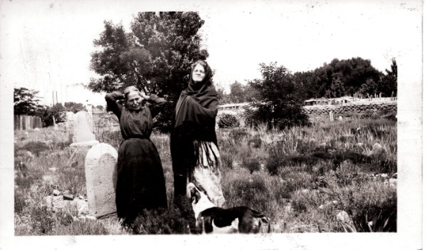
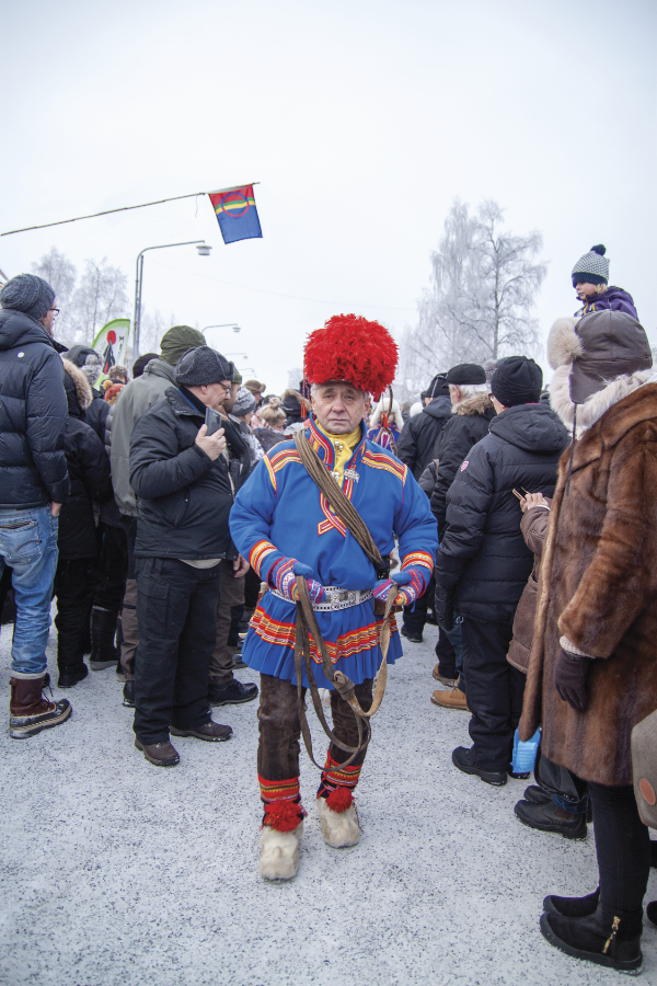
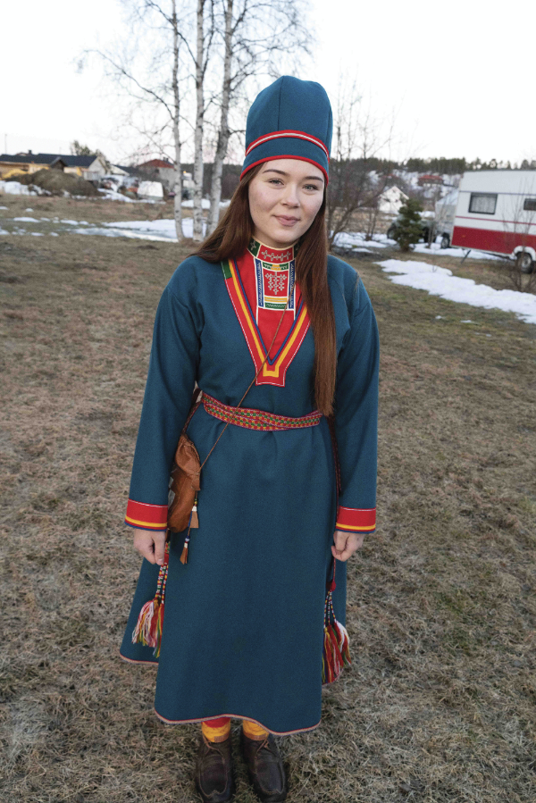
Photograph by Chloe Accardi, 2018.
A notable exception to the many immigrants who had felt compelled to hide their Sámi ancestry were the 126 men, women, and children who came from Sápmi to Alaska in 1894 and 1898 at the request of the United States government. Sheldon Jackson, general agent of education for Alaska, hoped that reindeer could ease a famine in Native communities on the Seward Peninsula that had been caused by destructive commercial hunting practices by both Russian and American hunters. Sámi families taught reindeer husbandry to local Yup’ik and Inupiaq apprentices. The Sámis arrived wearing garments of reindeer hide, reindeer leather, and wool, and continued to make and wear them in Alaska. (To share this little-known story, Báiki and the Sami Cultural Center created a traveling exhibition, The Sámi Reindeer People of Alaska. I first met Faith Fjeld, Marlene Wisuri, and Nathan Muus when my museum hosted the exhibition in 2012.)
Wisuri feels connected to Sámi culture. Her grandmother was from northern Finland. Wisuri grew up with stories that her grandmother’s family had reindeer, though she doesn’t think they herded them. “Grandpa called Grandma lappalainen,” Wisuri says, using the Finnish word for Sámi. Further genealogical research bears this out.
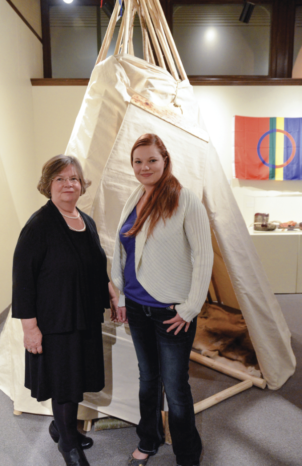
When the Sámi community began to connect through Báiki, they also began connecting in person at events, including Nordic cultural festivals held throughout the United States. An important part of the gatherings is the sharing of cultural heritage. Community members set up a lavvu, a conical tent, and demonstrate or set out examples of duodji, defined as “useful things made beautiful,” such as sheath knives, drinking cups, and coffee pouches.
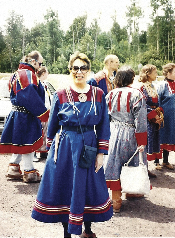
“There was the thought that we should be wearing something at events,” Wisuri recalls. Some of the women sewed print cotton dresses in the style of Sámi summer-weight gákti. “Everyone had one at the beginning. The pattern was passed around.”
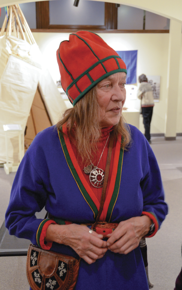
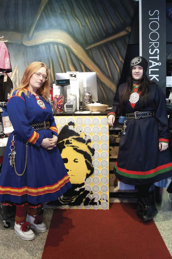
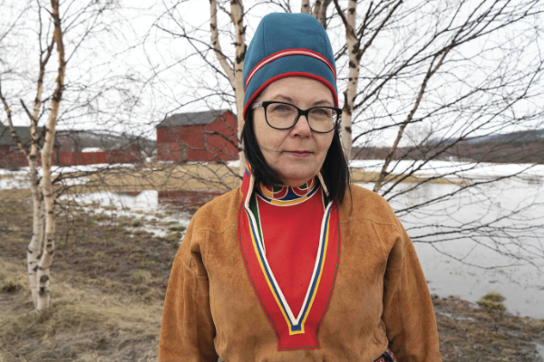
Gákti is the clothing used by Sámi people. The word describes the tunic-like and dress-like garments worn by men and women, respectively, and it also is the word used for the outfit of clothing. (The plural of gákti in North Sámi language is gávttit, but non-native speakers in North America commonly use gákti as both singular and plural.) There are many different gákti, and they generally follow the linguistic boundaries of the nine living Sámi languages. There are further variations by community and for summer and winter.
Fjeld was among the first in the community to travel to Sápmi and visit relatives. She began wearing a cotton dress made from the pattern that was passed around. In 1993, relatives gave her a wool winter gákti with the deep, V-shaped yoke characteristic of South Sámi gákti. Most members of the community in America, though, had not connected with family and were not even sure of where in Sápmi their ancestors were from. So Fjeld encouraged Wisuri and Gladys Koski Holmes (1932–2005), a visual artist and respected member of the Sámi-American community, to come up with something that would be appropriate to wear if one was uncertain of where their ancestors had come from. “We were thinking that a ‘North American gákti’ was something that we could all feel comfortable wearing.”
The “American gákti” designed by Wisuri and Holmes is a blue denim dress. Wide red bands at the shoulders, cuffs, and hem are overlaid with rows of blue, white, yellow, and black ribbon. The silhouette, colors, and rows of ribbon visually link this dress to many of the Sámi gákti. The colors and rows of ribbon were also chosen because of their use by and importance to Native American cultures. The colors are symbolic of the four directions, and the ribbon stripes link the dress to ribbon shirts worn as regalia at powwows and made to honor achievements.
Wisuri explains that combining Sámi and Native American elements in the garment was done out of respect. “There are the cultural connections of Indigenous people living in harmony with nature and personal connections,” she says, “as many of us in the Sámi community have Native American family members.”
“I made a prototype [of an American gákti], only a woman’s,” she continues. “I wore it several times, but the whole idea didn’t go very far. It wasn’t clear what the path was, but the path wasn’t to make American gákti.” As more members of the community were able to trace their own ancestry to specific locations in Sápmi, there was a stronger sense of what they should be wearing.
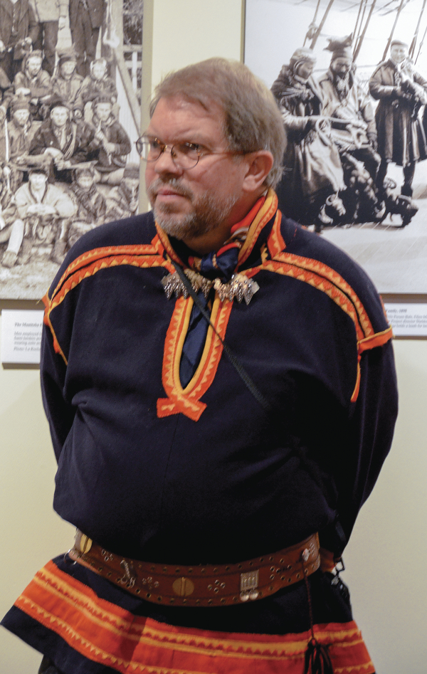
Nathan Muus is a leader of the Sámi-American community and lives in Oakland, California. A recent conversation focused on the cultural norms surrounding gákti and the living character of gákti, which he’s observed on many trips visiting friends and family in Sápmi. “Usually there is a tie to a family and where you are from,” he says. “That might signify a geographic area and even further delineation by a clan or family.
“You must be Sámi to sew and wear gákti. All in or not in at all. You are connected by family, not just genetics. A certain gene occurs in high percentages in Sámi populations, but that is not proof of being Sámi. Sámi people [in Sápmi] are offended if there is only a DNA connection and you wear gákti. … On one hand, there is the very strict opinion that you can only wear gákti if your family has made it and you are from that family. The other is that you can wear it if you have a family tie to that gákti.”
He follows the latter practice. His great-grandparents were from Nordland in Norway, and the gákti for this area of Norway is also worn in parts of Sweden. The gákti connects to both Muus and the Swedish-American woman who sewed it in 1995. It’s an older style gákti for Gárasavvon/Karesuanto/Karesuando, Sweden. “While Sámis in Sápmi can be bolder and experiment with gákti, they frown on Americans doing that,” Muus continues. “It’s all about understanding how far you can go, while staying within the cultural norms.”
Another layer of complexity is that in Sápmi, gákti tend to change style. “You can wear the older style, but they do change,” Muus says. “For example, the Kautokeino man’s gákti for a long time was royal blue with heavy red and white trim. It has gotten darker blue with dark red, almost metallic trim.” Muus was recently in northern Sweden; in contrast to his 25-year-old gákti, he said, “Everyone else’s was new, crisp, perfect.” He showed me a photo in a 2020 online newspaper article as an example. Not only did the fabric look crisper, the pleats at the hem of the gákti for Guovdageaidnu/Kautokeino in Norway came to very sharp points, not possible with the older style of heavier fabric.
Muus wears gákti at cultural events and festivals, especially when he is asked to speak or perform a traditional style of chanting and singing called joik. “If I’m wearing gákti with other Sámi people, I feel like an insider, part of the group. They know who you are and who you are related to. In the American public, you’re representing Sámi culture and you are comfortable with that, or not.” He is generally comfortable with it, and ready for the questions. Not all of the questions are unique to American viewers; even in Sápmi, wearers might have to explain, “This is why I’m wearing this.”
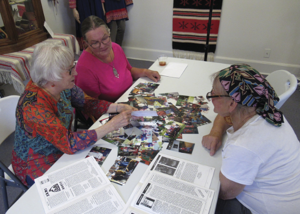
I visited the Sami Cultural Center recently. The center is located in a former school building in the Lakeside-Lester Park neighborhood in Duluth, Minnesota. Wisuri and I were joined by Nancy Olson and Laurel Sanders, two board members who have fairly recently learned that they have Sámi ancestry. We sat around a table looking at photographs from past gatherings. Wisuri told how challenging it has been for her and other Americans to learn about Sámi culture, history, and gákti. “Today, there is greater access to information about the different gákti, greater access to family in Sápmi and to gákti. There also seems to be greater scrutiny about what should and should not be worn.” She often sees comments in social media about posted photos.
For those who are “newly Sámi,” their enthusiasm in learning about gákti can often be quickly squelched by culture-bearers. “Some are writing from Sápmi, and they are certainly knowledgeable, but we’re different than they are. There’s so much mixed ancestry here. Identities were lost when our ancestors came here, and we can’t hold people responsible for that,” Wisuri says. While she is sometimes discouraged by critical attitudes, she does see people jumping in naively without looking into their family history and the history of gákti. While one can wear gákti proudly today, that has not always been the case. Under government policies of assimilation, called “Norwegianization” and “Swedification,” wearers of gákti faced verbal and sometimes physical harassment. Gákti represents cultural survival and ethnic identity, and that is only understood through research and reflection.
Wisuri recommends that people start with accessories, such as a traditional pin or brooch, a silk scarf with long fringe, a pewter-thread bracelet, or a hooded cape called a luhkkha. Nancy Olson says that for events at the Sami Cultural Center, she will often dress in one of the colors of the Sámi flag. She would like to wear a gákti and has started sewing one from a pattern shared by Wisuri: “It would be a representation of the culture. It would be a talking point about the reawakening of my heritage.”
In 2008, Olson was contacted by a relative who asked if she knew she had Sámi heritage. “I wasn’t aware of the Sámi heritage or even the word Sámi. Yet, my brothers who are three and six years older than me were aware of my maternal grandmother being [Sámi]. I’m not sure if my maternal grandfather was Sámi. He was born in Finland and came to the U.S. as a young man.” Her grandparents met in the Copper Country of the Upper Peninsula of Michigan. Later, they mined in Goldfield, Nevada, and homesteaded north of Chisholm, Minnesota.
The family’s Sámi ancestry was never openly discussed. When she asked her mother questions about family connections, she would receive vague answers like, “You’re too young to understand,” “There are some things we don’t talk about,” and “I’ll tell you when you are older and can keep a secret.”
“When I learned of my Sámi heritage, I joined a Finnish genealogy group. Marlene and Faith came to a meeting and showed the film Suddenly Sámi.” The 2009 documentary by Norwegian filmmaker Ellen-Astri Lundby records her discovery of her Sámi heritage. “It really piqued my interest to know about Sámi life. So I connected with Marlene and Faith. Their enthusiasm for Sámi heritage drew me in to discover more. At first, I had a romanticized vision of the reindeer people. Then I learned about their harsh nomadic life, forced assimilation, and loss of culture and language. Then I understood why that part of my own family story was hushed and very vague.”
Laurel Sanders sewed a gákti in about 1998 when she worked as an interpreter at the Sámi encampment at Minnesota Discovery Center in Chisholm, Minnesota. She copied the gákti that belonged to the previous interpreter. At the site, Sanders learned to weave bands and birch bark shoes. She said she loved being in the goahti, which is a conical or arched dwelling sometimes covered with turf. At that time, she didn’t know she had Sámi ancestry.
“I had known that my dad’s parents were from Norway. Then my cousin, the family genealogist, told me that her father said we were part ‘Laplanders.’ I asked my dad what he thought. He didn’t know, but recalled hearing about letters from relatives in Norway that mentioned trading fish for hides. I attended Sámi cultural events and presentations and read a lot to learn more. I have begun to look for any evidence in census records to corroborate my uncle’s statement. Independent from me, other cousins have also made strong connections to Sámi culture.”
Partly due to concerns that what they wear isn’t right, some members of the Sámi-American community choose not to wear gákti often or at all. Sanders continues, “The gákti I made to interpret at Minnesota Discovery Center is mine. I also wore it at the rededication of the site. Early on I wore it to a couple of powwows I attended with my Ojibwe children. I made komager [summer boots] to wear with it and have worn them on ‘Rock Your Mocs’ day. However, once I became more aware of the traditions around wearing gákti, that it should definitely reflect one’s family and region, I haven’t felt right about wearing it, since it is nonspecific. I still weave articles and make bags as gifts and demonstrate the craft. All I can say is what I know; I’ve been told that I have Sámi heritage and I value that.”
Thirty years after the first issue of Báiki, Faith Fjeld’s wish to see an awakening of Sámi spirit in America seems to have come true. Through the efforts of Fjeld, Wisuri, Muus, and many others, Sámi culture can more easily be learned, shared, and celebrated.
—
Laurann Gilbertson is chief curator at Vesterheim Norwegian-American Museum in Decorah, Iowa. She contributed an essay to the book accompanying the Dressing with Purpose exhibition.