

My mother was adopted through the Indian Adoption Project, a federal program that ran from 1958 to 1967 and was designed to assimilate Native children by placing them with white families. Unexpectedly, she was adopted by my Navajo and Choctaw grandparents. Both had their separate experiences of assimilation as children through the Indian Boarding School policy. In 1964, their work with the Bureau of Indian Affairs moved our family from the Navajo Nation to Los Angeles under the Indian Relocation Act.
These events fractured kinship and place across generations. Despite this, I eventually found my way back home to the Southwest.
In 1992, when I was seven years old, my mother reunited with her sister on the Navajo Nation. This moment marked a turning point in our family history and in my own sense of belonging. I carry vivid memories of the red rock rising behind my Aunt Jennie’s home and the rolling hills dotted with piñon trees—landscapes that quietly became part of my identity. In 2011, I moved from Los Angeles to Santa Fe to attend art school and to be closer to family and ancestral lands.
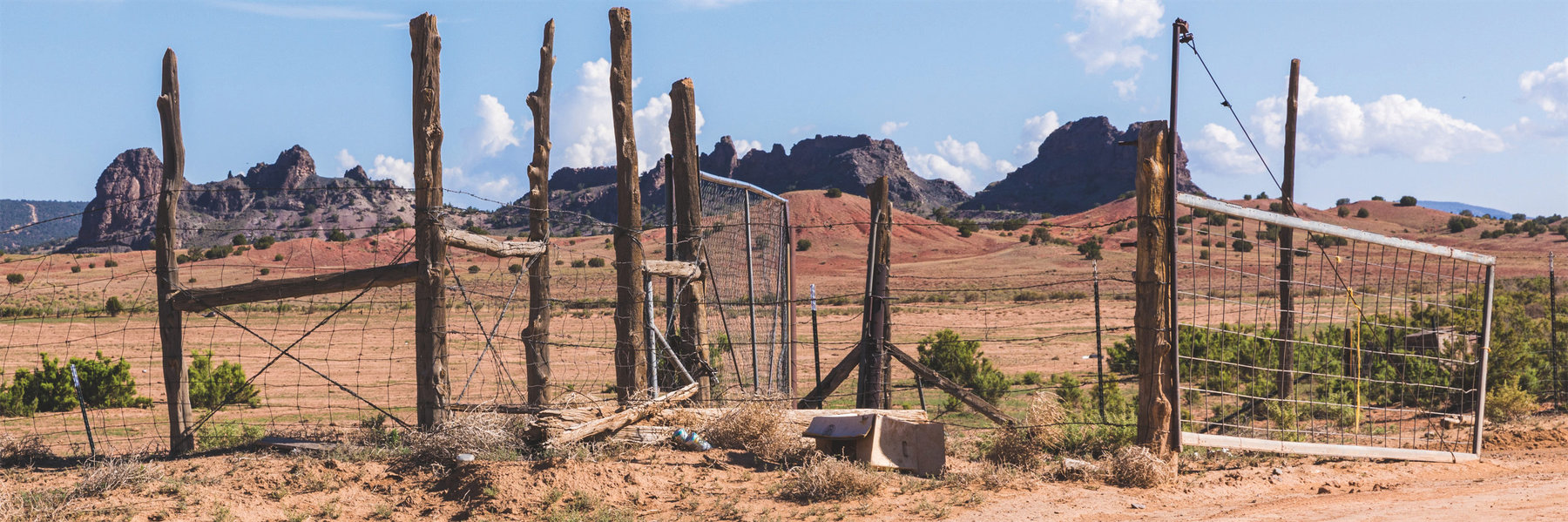
During my first months in Santa Fe, while navigating Google Earth late one night, I tried to locate my aunt’s home using highways and landmarks from memory. What I found instead was a coal mine—an abrupt scar cutting through the landscape I held so dearly. That discovery led me into deeper research on extractive industries, where I began to understand the devastating legacy of uranium mining across Indigenous lands.
As a child, I helped my mother navigate Los Angeles from the passenger seat using our local street atlas. Later, I began to see that the geospatial maps used by federal agencies, like those old paper atlases, were “official” top-down maps of the Navajo Nation that offered only a selective view: they could guide, inform, or conceal. By omitting details of homes, communities, and contamination, these maps continue to serve the interests of their creators––by maintaining systems of resource extraction and governance that prioritize profit and control over Indigenous sovereignty and environmental justice––rather than serving the people who live on the land.
I continue piecing my ancestry together through a personal project made universal, The Anti-Uranium Mapping Project. My traveling photography exhibition focuses on the largest uranium mine spill in U.S. history, which took place within the Navajo Nation. As I collaborate with people from impacted communities who feel like distant relatives, I know I’m closing a loop of trauma and pain from my lineage. In 2024,
I discovered that my great uncle, Herb Blatchford, had also made it his life’s work to expose the dangers of uranium mining. In my ongoing research, every literary reference to Herb is like a trail marker reassuring me on my path as I advocate for the land.
Acknowledging the land as a relative and allowing the people to speak on behalf of her needs tells a counter narrative through story mapping which conventional maps fail to recognize. If the land could speak, what would she say?