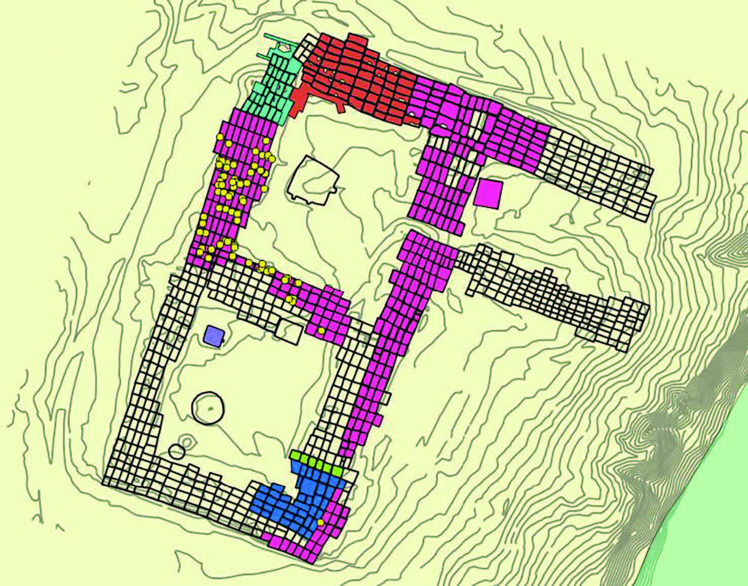
As part of this research project, historic maps and sketches have been combined with satellite imagery to create an accurate and comprehensive map of the remains of Kuaua Pueblo. Areas with solid color represent rooms that were excavated in the 1930s. Each color represents an individual archaeologist who was working at the site. The yellow dots mark artifacts that were found by Albert Ely in 1938. By mapping the architecture and artifacts in this way, we can begin to recognize patterns and interpret the site more accurately.